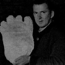


 Hairy Devil-Men of New Guinea
Chapter 19
Kurua Mila Maipala is
a giant cannibal man of the Orokolo forests. He steals women from our village.
He stands up to 8 or 9ft [2.6-3m] or more tall. His voice thunders trough
the trees whenever he is angry or hungry for human flesh.
This is how the people of Rebuana Village, situated in the Matalau district
of the Gazelle Peninsula, Papua New Guinea describe a fearsome manbeast who
has stalked the land since before the time of their ancestors.
They tell a story of two brothers who, intent upon capturing the monster,
dug a deep hole and covered it with foliage, attracting him out of the jungle
to chase them. As he did so he fell into the hole, whereupon the men speared
and beheaded him. For a time his head was displayed at the village.
Along the Peninsula coast the giant is called Lama, and deeper inland he is
also known as Lavata. Both names also refer to the coconut!
The tales obviously refer to a population of giant hominid creatures rather
than a single individual. The Papuans claim these people roam the interior
even today, killing and eating natives or stealing their women!
Such traditions as the above exist throughout the length and breadth of the
New Guinea continent. And, as with Australia, two types of giant beings are
involved; a giant man-like, tool-making people; and a giant ape-like [ie Gigantopithecine]
creature. There is also a race of pygmy-size natives. However, there is nothing
mysterious about these pygmies. Many live close to civilisation, working on
plantations, sawmills and other jobs alongside Papuans and whites, returning
to the jungle when their day's work is done.
The island continent of New Guinea covers approximately 868,000 square kilometres
by approximately 2,400 kilometres in length by about 1000 kilometres in width
at its widest point. Papua New Guinea alone comprises 1,200 kilometres in
length by 474,000 square kilometres in total landmass. 85% of Papua New Guinea
is mainland, the remaining 15% consists of 600 islands, lying in latitude
12.6; and extending to longitude 160 East.
This area includes the Trobriand Island, Woodlark Island, the D'Entrecasteaux
Islands and the Louisade Archipelago, the Bismarck Archipelago [New Britain,
New Ireland, Lavongai and the Admiralty Islands], and the two northermost
islands, the Solomon Islands - Buba and Bougainville.
Current archaeological/anthropological opinion suggests people first came
to New Guinea about 50,000 years ago, at a time when the sea levels of the
last ice-age were much lower than they are today and Australia/New Guinea
was a single landmass.
The 'official' scientific view is that the earliest arrivals 'island hopped'
to New Guinea on foot across still-joined south-east Asian islands, and by
water craft where stretches of ocean barred their way.
However, as with the
evidence for the presence of primitive 'relict hominids' in ice-age Australia
incapable of boat-building, this view does not explain how primitive sub-men
could have reached New Guinea or as will soon be revealed, the islands of
Melanesia southward to New Zealand.
It is there fore obvious that, contrary to the 'official' view, the present-day
islands of Melanesia [ie New Britain, New Ireland, the Solomons, Fiji, Tonga]
were all part of a much larger ice-age land shelf extending from New Guinea
and including what is now the submerged Norfolk Island Ridge to New Zealand.
The often great depths now separating many of these islands having been carved
out by thousands of years of ocean currents.
As the following evidence will demonstrate for the remainder of this book,
stone-age occupation of the New Guinea/New Zealand region of the Pacific must
eventually be shown to be of far greater antiquity than is presently accepted.


